
.avif)
Find & Read
No items found.
_28.avif)


.svg)
Bio
Zamalka is a community in central Eastern Ghouta, in Rural Damascus Governorate, lying directly east of the Damascus neighbourhood of Jobar. It sits within the agricultural belt on the eastern edge of the capital, and has long combined a residential role on the Damascus metropolitan fringe with farming land tied to the wider Ghouta. REACH recorded a total population of 13,500 in its community assessment of late December 2017, of whom 3,650 were internally displaced persons.
What distinguishes Zamalka is its position at the meeting point of orchard land and metropolitan settlement: close enough to Damascus to function as part of its daily economy, and embedded in the Ghouta's cultivated belt. REACH recorded the community's educational infrastructure as pre-conflict primary, secondary and high schools, while medical provision at the time of assessment consisted of mobile clinics, field hospitals and informal emergency care points rather than a standing facility. The road linking Zamalka with the neighbouring city of Arbin remains the community's main connection to the surrounding Ghouta network.
Damages
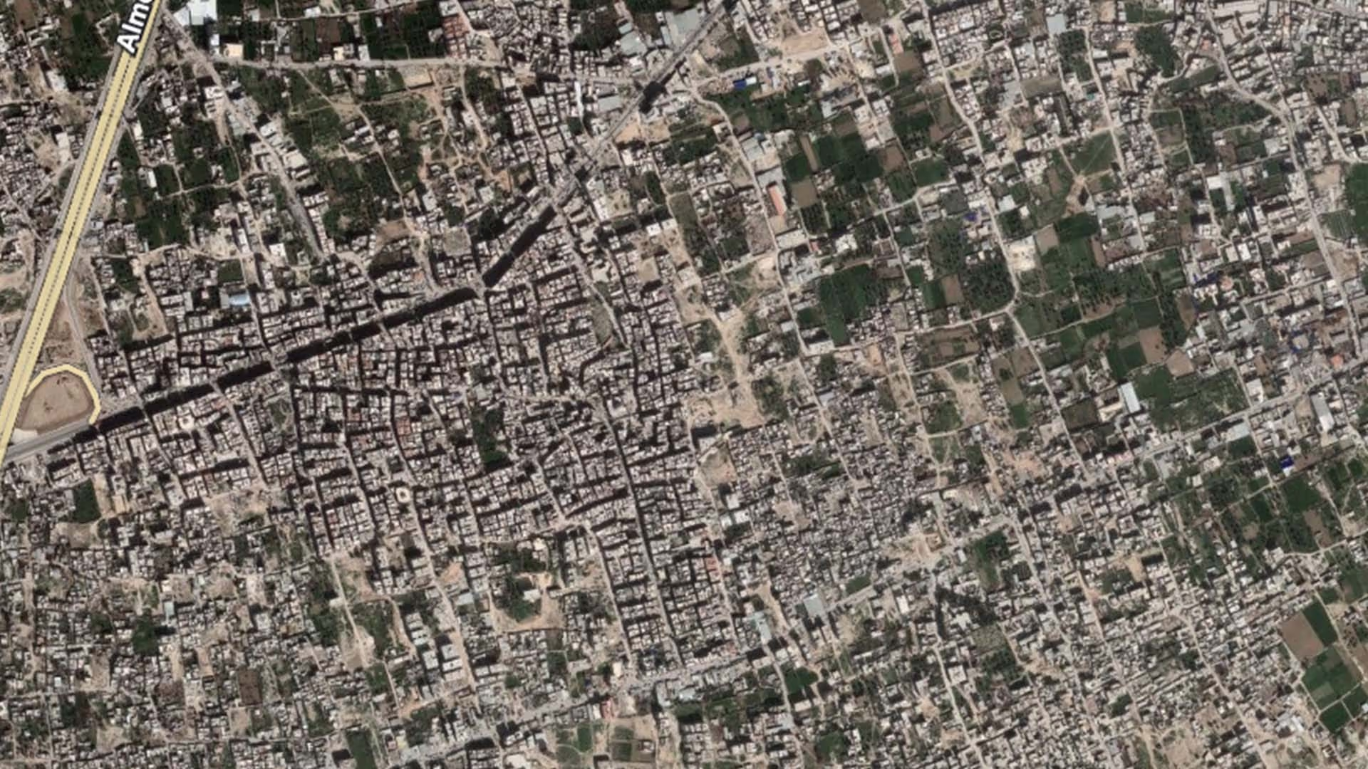
Satellite analysis published by REACH Initiative with the UN Satellite Centre (UNOSAT) in January 2018, based on imagery of 3 December 2017, found that 59% of structures in Zamalka were damaged or destroyed — the third highest share among the localities assessed in the area. The same assessment recorded shares of 93% in Jobar, 71% in Ein Terma, 38% in Arbin, 27% in Jisrein, 21% in Kafr Batna, 13% in Saqba and 11% in Hammura, placing Zamalka in the upper range of a heavily affected cluster.
The same REACH assessment recorded that 75–99% of the pre-conflict population had been displaced from the community, and that access to the water and electricity networks had not been reported since assessments of Zamalka began in June 2016. These figures describe conditions as of late 2017 and early 2018; no institutional reassessment specific to Zamalka has been published since, so no current population, damage or service figure for the community is available.
Recovery work reaching Zamalka is documented at the corridor level. SANA reported on 15 July 2026 that the Ministry of Emergency and Disaster Management, in cooperation with the Arbin City Council, had launched a debris-removal campaign covering Arbin city and the road linking Arbin with Zamalka; the campaign targets the removal of approximately 50,000 cubic metres of rubble, with nearly 2,000 cubic metres cleared in the opening days, with the stated aims of reopening transport routes, restoring infrastructure and enabling reconstruction. At the governorate level, OCHA's Rural Damascus profile of June 2026 records 150,224 IDP returns to Rural Damascus between December 2024 and 31 May 2026, citing the IOM Displacement Tracking Matrix, and notes that returns across Eastern Ghouta are taking place amid extensive infrastructure damage, limited basic services and insufficient investment.
.svg)

.png)


